
Read Sierra Leone from the ground up
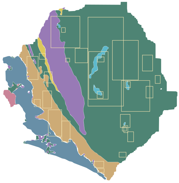
Switch between three published datasets, filter by commodity or licence type, and select any area to see what the source documents say about it. Tilt to 3D to see the geology over real terrain.
Loading the atlas. The map and terrain download only when you reach this section.
The interactive map could not start. It needs a browser with WebGL and an internet connection. The datasets are also available as official maps from the National Minerals Agency.
Satellite-Based Mineral Targeting
Identify and prioritise mineral targets before you drill.
Aurimet delivers satellite-based mineral exploration services using multispectral and hyperspectral Earth observation data to identify, delineate and prioritise mineral targets before capital is committed to drilling.
For any commodity, our analysis defines high-prospectivity target zones, interprets the structural framework controlling mineralisation (including faults, shear zones and alteration systems) and provides indicative depth estimates. Each target is assigned a confidence ranking, enabling you to direct ground sampling and drilling programmes with greater precision, shorten exploration timelines and reduce field expenditure.
01
Premium Report
- Per commodity, up to 50 hectares
- Target zone delineation, structural geological interpretation and a prospectivity heatmap.
02
Premium Report+
- Per commodity, up to 50 hectares
- All Premium Report deliverables, plus TargetMax™ drilling intelligence and an interactive three-dimensional subsurface model.
Pricing is available on request. Licence areas exceeding 50 hectares are quoted individually, with significant volume-based discounts.
To receive a tailored proposal, please share the coordinates or boundary file for your licence area (shapefile, KML or corner-point format).
Request a ProposalDocumented occurrences
Areas where a commodity is documented on the November 2009 occurrence map. They show where the source records a commodity, not how much is there.
Mineral rights
A snapshot of NMA licences and applications at the end of September 2026. Always confirm current status and compliance with the National Minerals Agency.
Not shown
Interpreted exploration targets, confirmed mineral resources, geophysical interpretations and mineral-favourability models. None are in the supplied datasets, so none are drawn.
Mineral occurrences as a table
| ID | Commodity | Status in source | Approx. centre | Approx. extent |
|---|---|---|---|---|
| Bauxite | Occurrence area | 7.77°N, 12.20°W | 16 × 39 km | |
| Bauxite | Occurrence area | 8.86°N, 12.78°W | 21 × 44 km | |
| Bauxite | Occurrence area | 8.32°N, 12.52°W | 17 × 32 km | |
| Columbite-tantalite | Occurrence area | 8.73°N, 11.63°W | 37 × 90 km | |
| Columbite-tantalite | Occurrence area | 7.95°N, 11.17°W | 18 × 25 km | |
| Columbite-tantalite | Occurrence area | 7.68°N, 11.08°W | 11 × 19 km | |
| Diamonds (kimberlite) | Proven | 8.38°N, 10.99°W | 54 × 59 km | |
| Diamonds (kimberlite) | Indicated | 9.51°N, 12.24°W | 7 × 9 km | |
| Diamonds (kimberlite) | Proven | 7.20°N, 11.62°W | 18 × 12 km | |
| Gold | Occurrence area | 9.48°N, 12.21°W | 55 × 60 km | |
| Gold | Occurrence area | 8.95°N, 10.78°W | 19 × 30 km | |
| Gold | Occurrence area | 8.97°N, 11.51°W | 68 × 168 km | |
| Gold | Occurrence area | 8.57°N, 11.13°W | 10 × 11 km | |
| Gold | Occurrence area | 8.45°N, 10.75°W | 13 × 22 km | |
| Gold | Occurrence area | 8.66°N, 10.61°W | 10 × 15 km | |
| Gold | Occurrence area | 7.81°N, 11.19°W | 8 × 8 km | |
| Gold | Occurrence area | 9.00°N, 12.17°W | 8 × 7 km | |
| Gold | Occurrence area | 9.07°N, 11.93°W | 24 × 27 km | |
| Gold | Occurrence area | 9.00°N, 11.17°W | 49 × 75 km | |
| Iron ore | Occurrence area | 8.70°N, 12.50°W | 15 × 21 km | |
| Iron ore | Occurrence area | 9.01°N, 11.60°W | 13 × 10 km | |
| Iron ore | Occurrence area | 8.40°N, 11.60°W | 11 × 13 km | |
| Iron ore | Occurrence area | 7.37°N, 11.22°W | 13 × 9 km | |
| Iron ore | Occurrence area | 7.10°N, 11.59°W | 13 × 7 km | |
| Iron ore | Occurrence area | 7.81°N, 11.16°W | 8 × 13 km | |
| Rutile | Occurrence area | 7.91°N, 12.39°W | 26 × 50 km | |
| Rutile | Occurrence area | 8.26°N, 12.69°W | 12 × 14 km | |
| Rutile | Occurrence area | 9.06°N, 12.61°W | 12 × 11 km |
Preliminary mineral intelligence prepared by Aurimet Group from public sources. Outlines were digitised from supplied maps and are approximate. These are not certified official National Minerals Agency maps and are not a statement of mineral potential, ownership or resource. Please verify licence status with the National Minerals Agency.